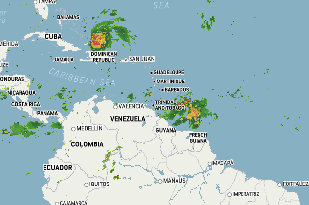
The Trinidad and Tobago Meteorological Service (TTMS) has advised that they are continuing to monitor the progress of an active tropical wave to the east of the southern Windward Islands.
According to the TTMS, the system currently has a low potential (10%) for development in the next two days. There is a medium potential (50%) for cyclone development in the next five (5) days.
The Met Service also said that as of 8:00 am, the axis of the tropical wave was near 54W, with the leading edge about 450km east of the Southern Windward Islands. The wave is accompanied by heavy showers and thunderstorms moving westward at 28 km/h. There is the possibility of gradual development over the next few days.
According to a statement from the TTMS: “On this present course, this system is expected to move across the Windward Islands during Wednesday/Thursday. Regardless of cyclone development, this system is expected to bring unstable conditions, resulting in moderate to heavy rainfall accompanied by thunderstorm activity, affecting Trinidad and Tobago and the Windward Islands.
At this present time, there are no alerts, watches or warnings in effect. The TTMS continues to monitor this tropical wave and will issue an update at 6:00 pm this evening or earlier if the situation warrants.”